
About Monaco
Monaco is a sovereign city-state of 2.08 square kilometres on the French Riviera, bordered by France on three sides and by the Mediterranean on the fourth – after the Vatican, the second-smallest country in the world. The House of Grimaldi has ruled it, with brief interruptions, since 8 January 1297, when François Grimaldi, disguised as a Franciscan friar, talked his way into the fortress on the Rock and opened the gates to his men. The two sword-carrying monks on Monaco's coat of arms still tell the story. French is the official language, and the Franco-Monégasque Treaty of 1861 settled the principality's sovereignty.
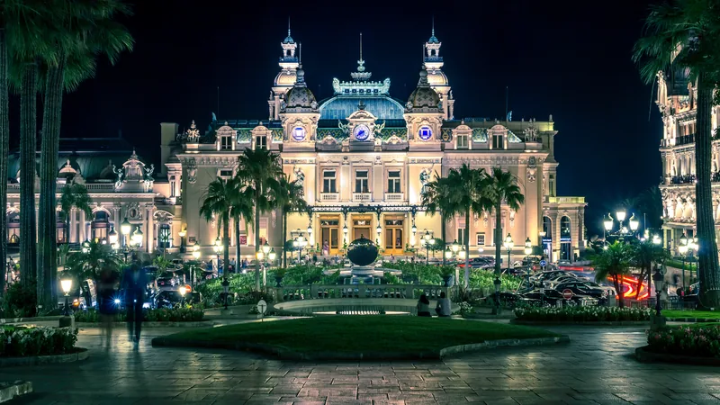
Modern Monaco was invented in the 1860s. In 1856 Charles III granted a concession for sea bathing and a casino; in 1866 the bare Spélugues plateau across the harbour was renamed Monte-Carlo, Mount Charles; and in 1868 the railway arrived. The Casino and the Salle Garnier of 1878–79, by Charles Garnier and Jules Dutrou, set the Belle Époque register – turrets, balconies, pinnacles, coloured ceramics and caryatids – that still defines Monte-Carlo.
The twentieth century added height and land. Larvotto was laid out on the shore in the 1960s; Fontvieille was won from the sea between 1966 and 1973 to a plan by the architect Manfredi Nicoletti; and Mareterra, six hectares of new land between Port Hercule and the Grimaldi Forum, was inaugurated on 4 December 2024. The towers of the 1960s to the 1980s – Le Millefiori, L'Annonciade, Parc Saint Roman – were overtaken in 2015 by Alexandre Giraldi's 170-metre Tour Odéon, the tallest building in the principality.
The country climbs from the water to more than 160 metres at the Chemin des Révoires in a few hundred metres, so streets turn into stairways, hairpins and public lifts. This guide covers all of it: the nine quartiers, 262 streets and 1,247 buildings, the restaurants, shops, museums, gardens and viewpoints – every fact with its source.
The lists
- Restaurant · LarvottoBlue Bay Marcel Ravin
Marcel Ravin's two-star Caribbean-Mediterranean table at the Monte-Carlo Bay
- Restaurant · Monte-CarloLe Grill
The one-star rooftop grill of the Hôtel de Paris, under a roof that slides open
- Restaurant · Monte-CarloPavyllon
Yannick Alléno's one-star counter at the Hermitage, with a garden terrace over the sea
- Restaurant · La CondamineCaffè Milano
An Italian restaurant with a rooftop and terrace over the port
- Restaurant · LarvottoCOYA Monte-Carlo
Peruvian and Latin American cooking with a pisco bar, at the Sporting
- Restaurant · LarvottoLas Brisas
The Monte-Carlo Bay's summer terrace over the sea, Mediterranean and grilled
- Restaurant · Monte-CarloLe Louis XV – Alain Ducasse à l’Hôtel de Paris
Alain Ducasse's three-star Mediterranean table at the Hôtel de Paris
- Restaurant · LarvottoBlue Bay Marcel Ravin
Marcel Ravin's two-star Caribbean-Mediterranean table at the Monte-Carlo Bay
- Restaurant · Monte-CarloLes Ambassadeurs by Christophe Cussac
Christophe Cussac's two-star room at the Métropole, dressed by Jacques Garcia
- Restaurant · Monte-CarloL’Abysse Monte-Carlo
Yannick Alléno's two-star sushi counter at the Hôtel Hermitage
- Restaurant · Monte-CarloLe Grill
The one-star rooftop grill of the Hôtel de Paris, under a roof that slides open
- Restaurant · Monte-CarloPavyllon
Yannick Alléno's one-star counter at the Hermitage, with a garden terrace over the sea
- Restaurant · Monte-CarloRampoldi
The Monte-Carlo brasserie that hides Antonio Salvatore's one-star five-table room
- Restaurant · LarvottoRobuchon Monaco
A one-star tribute to Joël Robuchon on the Esplanade du Portier, new in 2026
- Restaurant · FontvieilleBeefbar
A meat bar on the Fontvieille quay, in the MICHELIN Guide
- Café · Monte-CarloCafé de Paris
The brasserie of the Place du Casino since 1868, where crêpe Suzette was born
- Restaurant · Monte-CarloEm Sherif Monte-Carlo
Lebanese sharing plates at the Hôtel de Paris, in the MICHELIN Guide
- Restaurant · LarvottoLa Table d’Élise
A modern brasserie with an open kitchen near the Japanese Garden, in the MICHELIN Guide
- Restaurant · LarvottoLa Note Bleue
A Larvotto beach restaurant since 2001, named after a saxophonist
- Bar · LarvottoLe Méridien • Alang Beach Bar
The Méridien's beach bar, 22 Avenue Princesse-Grace
- Restaurant · LarvottoLe Neptune
A Larvotto beach restaurant with a children's menu
- Restaurant · LarvottoMiami
Larvotto's beach restaurant since 1975, pizzas from the wood oven
- Beach club · LarvottoMéridien Beach Plaza
The private beach of Le Méridien Beach Plaza on the Larvotto
- Restaurant · Monte-CarloNikki Beach Monte Carlo
The rooftop beach club of the Fairmont, open in the season since 2015
- Restaurant · Monte-CarloLes Ambassadeurs by Christophe Cussac
Christophe Cussac's two-star room at the Métropole, dressed by Jacques Garcia
- Casino · Monte-CarloCasino de Monte Carlo
![Casino de Monaco]()
François Blanc's casino of 1865, rebuilt by Charles Garnier in 1878–79
- Bar · Monte-CarloGustave
The Hermitage's cocktail lounge under the Winter Garden's glass roof
- Hotel · Monte-CarloHermitage
The SBM's Belle Époque hotel of 1896 by Jean Marquet, with an Eiffel-linked cupola
- Hotel · Monte-CarloHôtel de Paris
The SBM's first palace, opened in 1864 on the Place du Casino
- Restaurant · Monte-CarloLe Train Bleu
An Italian dinner restaurant inside the Casino, dressed as a Belle Époque dining car
- Bar · Monte-CarloLounge Bar Salle Europe
The bar of the Casino's main gaming room, under gilding and frescoes
- Hotel · Monte-CarloMetropole
Hans-Georg Tersling's hotel of 1889 on Avenue de la Madone, home of Les Ambassadeurs
- Theatre · Monte-CarloOpéra de Monaco
Charles Garnier's opera house of 1879, built onto the Casino in eight and a half months
- Place of worship · Jardin ExotiqueAntoinist temple of Monaco
![Antoinist temple of Monaco, Jardin Exotique, Monaco]()
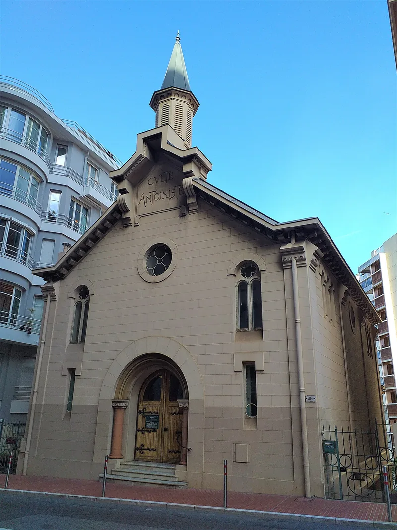
The Antoinist temple of 1913 on Boulevard du Jardin-Exotique
- Apartment building · Monte-CarloApartment building on Boulevard Princesse Charlotte
Villa Lamartine, completed in 1899
- Apartment building · MoneghettiApartment building on Chemin de la Turbie
Villa des Garets, completed in 1899 – Eugène Marquet
- Theatre · Monte-CarloAuditorium Rainier III
The concert hall of the Monte-Carlo Philharmonic, on Boulevard Louis-II
- Casino · Monte-CarloCasino de Monte Carlo
![Casino de Monaco]()
François Blanc's casino of 1865, rebuilt by Charles Garnier in 1878–79
- Cinema · La CondamineCinéma des Beaux-Arts
The cinema in the Théâtre Princesse-Grace building on Avenue d'Ostende
- Arts centre · FontvieilleEspace Léo Ferré
Arts centre on Avenue Albert II
- Gallery · Monte-CarloHauser & Wirth
Hauser & Wirth's gallery on the Promenade Princesse-Charlène
- Museum · La CondamineLa Collection de Voitures de SAS Le Prince de Monaco
Prince Rainier III's car collection of about a hundred vehicles, by Port Hercule
- Gallery · LarvottoLart Universe Montecarlo
Beniamino Levi's gallery of contemporary art at Mareterra
- Mall · Monte-CarloLe Métropole
Shopping centre at 17 Avenue des Spélugues
- Bar · Monte-CarloLounge Bar Salle Europe
The bar of the Casino's main gaming room, under gilding and frescoes
- Gallery · FontvieilleMonalisa motorsport gallery formula 1
Gallery on Quai Jean-Charles Rey
- Museum · Monaco-VilleMusée de la Chapelle de la Visitation
A seventeenth-century chapel on the Rock that shows old master paintings
- Museum · FontvieilleMusée des Timbres et des Monnaies
The Prince's collections of stamps and coins, on the Terrasses de Fontvieille
- Café · FontvieilleCafé du Cirque de Monte-Carlo
The café of the Chapiteau de Fontvieille
- Attraction · FontvieilleChapiteau de Fontvieille
The permanent big top on Avenue des Ligures, Fontvieille
- Café · FontvieilleEmilie’s Cookies
A cookie café on Promenade Honoré-II
- Fast food · LarvottoGlacier Mullot
Mullot's ice creams and sandwiches on Avenue Princesse-Grace
- Ice cream · La CondamineHäagen-Dazs
Häagen-Dazs on Boulevard Albert-Ier
- Park · Monte-CarloJardin des Boulingrins
Public garden on Allées des Boulingrins
- Playground · La RousseJardin Des Enfants
Playground on Avenue de l'Annonciade
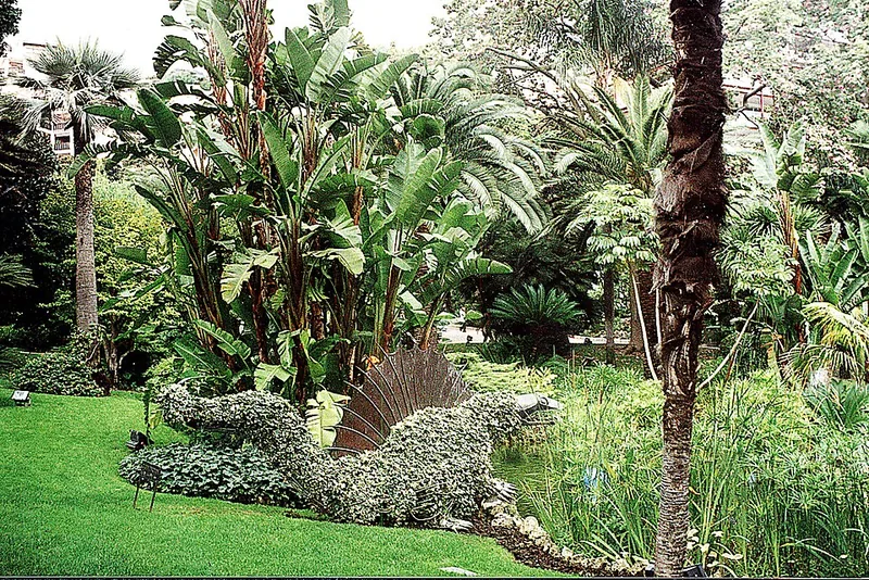
- Garden · Jardin ExotiqueJardin Exotique
![Jardin Exotique de Monaco, Jardin Exotique, Monaco]()
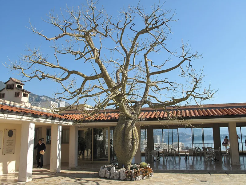
The cliff garden of succulents opened in 1933, above the Observatoire cave
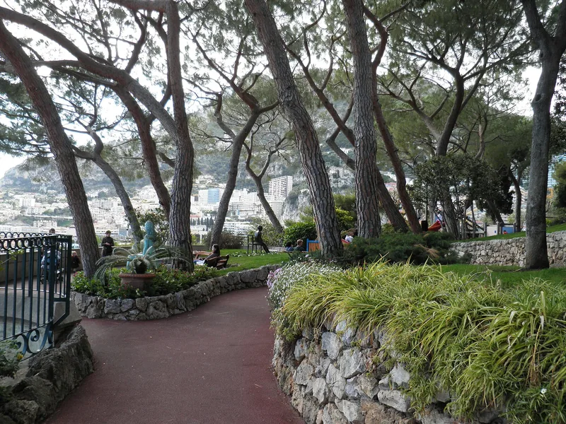
- Park · LarvottoJardin Japonais
![Japanese Garden, Larvotto, Monaco]()
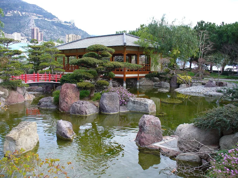
Yasuo Beppu's Japanese garden on Avenue Princesse-Grace, commissioned by Rainier III
- Park · Monte-CarloJardins de la Petite Afrique
![Little Africa Gardens, Monte-Carlo, Monaco]()
Public garden on Avenue de la Madone
- Garden · Monaco-VilleJardins de Saint-Martin
![St Martin Gardens, Monaco-Ville, Monaco]()
Monaco's oldest public garden, hung on the Rock's cliff above the sea
- Museum · La CondamineLa Collection de Voitures de SAS Le Prince de Monaco
Prince Rainier III's car collection of about a hundred vehicles, by Port Hercule
Search Monaco
Itineraries
- ItineraryOne day in Monaco
![Monaco in the morning on the French Riviera]()
From the Rock to Monte-Carlo and the Larvotto on foot: museum, palace guard, market, Casino.
- ItineraryTwo days in Monaco
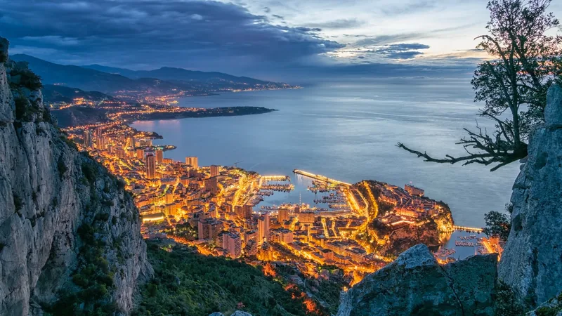
![Night view of Monaco from the mountain]()
Day one on the Rock and in Monte-Carlo; day two on the heights of the Jardin Exotique and in Fontvieille.
- ItineraryThe Grand Prix weekend
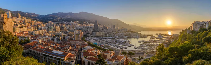
![Monaco harbour sunrise panorama city skyline]()
The circuit's landmarks on foot, from Sainte-Dévote to the Rascasse.
The sights
 Musée océanographique de MonacoMonaco-VilleBerthold Werner · CC BY-SA 3.0
 Prince's Palace of MonacoMonaco-VilleJorge Franganillo · CC BY 4.0
 Monaco Top Cars CollectionLa CondamineGael13011 · CC BY 3.0
 Museum of Stamps and CoinsFontvieilleВалерий Дед · CC BY 3.0
 Museum of Prehistoric AnthropologyJardin ExotiqueJean-Pierre Dalbéra from Paris, France · CC BY 2.0
 Opéra de Monte-CarloMonte-CarloGilbert Bochenek · CC BY-SA 3.0
 Cathedral of Our Lady ImmaculateMonaco-VilleUser:Berthold Werner · CC BY-SA 3.0
 Jardin Exotique de MonacoJardin ExotiqueTangopaso · Public domain
 Musée de la Chapelle de la VisitationMonaco-VilleHans1967 · CC BY-SA 3.0
 Japanese GardenLarvottoUser:Parisette · Public domain
 Monaco HeliportFontvieillegiggel · CC BY 3.0
 Port HerculesLa CondamineFilip Maljkovic · Public domain
The quartiers
The quartiers
Hours of sun on 21 March on the apartment buildings' sunniest façade (median; VERA PI's model, Copernicus GLO-30 terrain).
Tap a quartier for its page. The map is also embeddable: https://vpios.com/monaco/allt?inb=1
The quartiers ranked by sun in march
| # | Quartier | Floors | Sun, 21 March | Sun, 21 Dec. | Streets | Buildings |
|---|---|---|---|---|---|---|
| 1 | Larvotto | 11 floors | 8.8 h | 6.7 h | 13 | 76 |
| 2 | Saint-Roman | – | 8.5 h | 5.8 h | 3 | 20 |
| 3 | Jardin Exotique | 6 floors | 8.0 h | 7.0 h | 20 | 185 |
| 4 | Fontvieille | 9 floors | 7.7 h | 5.5 h | 23 | 93 |
| 5 | La Rousse | – | 7.7 h | 5.3 h | 12 | 98 |
| 6 | Moneghetti | 8 floors | 7.1 h | 5.0 h | 22 | 160 |
| 7 | Monte-Carlo | 5 floors | 7.0 h | 5.3 h | 66 | 300 |
| 8 | Monaco-Ville | 4 floors | 6.2 h | 3.8 h | 38 | 85 |
| 9 | La Condamine | 4 floors | 5.6 h | 2.8 h | 65 | 230 |
Floors and sun: the median of each quartier's apartment buildings. No price is shown: Monaco publishes no open per-sale records, and IMSEE's district price statistics may not be republished under its terms.
Monaco in numbers
| Population | 38,857 | Wikidata (Q235, P1082), CC0, 1 January 2025 |
|---|---|---|
| Area | 2.08 km² | Wikidata (Q235, P2046), CC0 |
| Quartiers | 9 | VERA PI (OpenStreetMap) |
| Named streets | 262 | OpenStreetMap |
| Buildings | 1,247 | OpenStreetMap |
| Apartment buildings | 405 | OpenStreetMap |
| Landmarks and public buildings | 117 | OpenStreetMap, Wikidata |
| Tallest building in OpenStreetMap | 111 m | OpenStreetMap |
| Restaurants, cafés and bars | 207 | OpenStreetMap |
| Shops | 179 | OpenStreetMap |
| Parks and gardens | 51 | OpenStreetMap |
| Viewpoints | 22 | OpenStreetMap |
| Sights | 231 | Wikidata, OpenStreetMap |
| Bus lines | 13 | CAM GTFS |
| Bus stops | 99 | CAM GTFS |
| Daylight on 21 December | 8.9 h (08:03–16:55) | NOAA |
| Daylight on 21 June | 15.4 h (05:51–21:15) | NOAA |
| Sun on 21 March, apartment buildings (median) | 7.2 h | VERA PI’s model |
Counts from the open data VERA PI reads, 25 October 2026. IMSEE's official statistics are not reproduced: its terms allow private use only.
Places to know
The ten in each list nearest the Casino, the port and the Palace – a selection by place, never by rating.
Eat & drink
- Amazónico Monte-CarloRestaurant · Place du Casino
- Bar de la Salle BlancheBar · Place du Casino
- Café de la RotondeCafé · Place du Casino
- Café de ParisCafé · Place du Casino
- Cédric Grolet Monte-CarloCafé · Avenue des Beaux-Arts
- Le Bar AméricainBar · Avenue de Monte-Carlo
- Le Louis XV - Alain Ducasse à l'Hôtel de ParisRestaurant · Place du Casino
- Le Train BleuRestaurant · Place du Casino
- Lounge Bar Salle EuropeBar · Place du Casino
- Salle EmpireRestaurant · Avenue des Beaux-Arts
Shops
- arijeWatches · Allée François Blanc
- CartierJewelry · Avenue des Beaux-Arts
- ChaumetJewelry · Allée François Blanc
- Chopard BoutiqueJewelry · Place du Casino
- GraffJewelry · Place du Casino
- Jaeger-LeCoultreWatches · Allée François Blanc
- Loro PianaClothes · Allée François Blanc
- Tiffany & CompanyJewelry · Allée François Blanc
- Van Cleef & ArpelsJewelry · Avenue de Monte-Carlo
- Zegg & Cerlatti - RolexWatches · Place du Casino
Hotels
- AmbassadorHotel · Avenue Prince Pierre
- de FranceHotel · Rue de la Turbie
- FairmontHotel · Boulevard du Larvotto
- HermitageHotel · Square Beaumarchais
- Hôtel de ParisHotel · Place du Casino
- Le BristolHotel · Boulevard Albert 1er
- Les CaravellesHotel · Boulevard Albert 1er
- MetropoleHotel · Avenue de la Madone
- MiramarHotel · Avenue John F. Kennedy
- Port PalaceHotel · Avenue John F. Kennedy
Culture
- Casino Café de ParisCasino · Place du Casino
- Casino de Monte CarloCasino · Place du Casino
- Chrome BallArtwork · Allée François Blanc
- Jules MassenetArtwork · Place de l'Opéra
- Les Caves de l'Hôtel de ParisAttraction · Place du Casino
- MaliziaArtwork · Rampe Major
- Opéra de MonacoTheatre · Place de l'Opéra
- Palais princier de MonacoAttraction · Tunnel Rocher Palais
- Rainier IIIArtwork · Rampe Major
- Sky MirrorArtwork · Place du Casino
The signature events
- 1929Monaco Grand PrixEvery year in late spring, on the streets of Monte-Carlo and La Condamine – since 1929
- 1911Monte Carlo RallyEvery year in January, finishing in Monaco – since 1911
- 1897Monte-Carlo MastersEvery year in April, at the Monte-Carlo Country Club, just across the border in Roquebrune-Cap-Martin – since 1897
- 1991Monaco Yacht ShowEvery year in September, in Port Hercule – since 1991
- 1974International Circus Festival of Monte-CarloEvery year in January, under the big top in Fontvieille – since 1974
- ·Herculis athletics meetingEvery summer, at the Stade Louis II
- 2015Monaco ePrixIn spring, on the Grand Prix circuit – since 2015
- ·Historic Grand Prix of MonacoEvery two years in spring, on the Grand Prix circuit
- 1961Monte-Carlo Television FestivalEvery year in June, at the Grimaldi Forum – since 1961
- ·National DayEvery year on 19 November, across the principality, with the ceremonies in Monaco-Ville
Recurring events, from Wikipedia and Wikidata. This year's dates are on the organisers' own sites.
Share
Its own link and its own card – for a message, a story or a plan for the evening.
Sources
Quartiers, buildings, streets and places: © OpenStreetMap contributors, ODbL 1.0. Sights: Wikidata (CC0), Wikipedia (CC BY-SA 4.0), Wikimedia Commons. Buses: Compagnie des Autobus de Monaco GTFS (Licence Ouverte 2.0). Sun: VERA PI's model with the Copernicus GLO-30 terrain. The text: VERA PI.
Wikipedia (en): Monaco
Wikipédia (fr) : Monaco-Ville
Wikipedia (en): Monte Carlo
Wikipedia (en): Land reclamation in Monaco
Wikipédia (fr) : Fontvieille (Monaco)
Wikipedia (en): Le Portier
Wikipedia (en): List of tallest buildings in Monaco
VERA PI – OpenStreetMap counts
Photo: Benjamin Sibuet/Adobe Stock