About the street
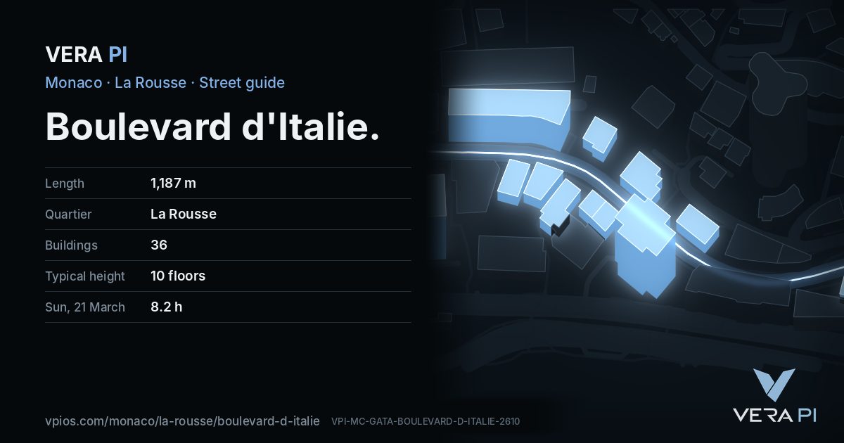
Boulevard d'Italie runs some 1.2 kilometres along the eastern hillside of La Rousse and Saint-Roman towards the Italian side – hence its name. It was a street of villas: several survive on the State's list of remarkable buildings, among them the Villa Riberi of 1908 by Victor Isouard and the Villa Le Rêve of 1888, while others gave way to towers. Today it holds the Carmelites' church and, at no. 68, the twin towers of Testimonio II, handed over in 2024.
Walk the street
Every apartment building and landmark on Boulevard d'Italie, drawn at its height from OpenStreetMap. Walk it with the slider, switch sides, or tap a building for its card.
Skip the mapEverything along the street
Building by building
36 buildings with their own page on Boulevard d'Italie. Tap one to see it on the map.
Odd numbers 6
- 21House4 floors · Sun on 21 March: 9.0 h on the sunniest façade (SSE)
- 25HouseSun on 21 March: 6.4 h on the sunniest façade (SW)
- 29Le Rocazur8 floors · Sun on 21 March: 8.9 h on the sunniest façade (SSE)
- 35Le Florestan13 floors · Sun on 21 March: 8.9 h on the sunniest façade (S)
- 39-41L'AtlantisSun on 21 March: 4.4 h on the sunniest façade (E)
- 49Les Villas Del SoleSun on 21 March: 9.4 h on the sunniest façade (SSE)
Even numbers 30
- ·HouseSun on 21 March: 4.1 h on the sunniest façade (ESE)
- 8Apartment buildingSun on 21 March: 6.4 h on the sunniest façade (SE)
- ·HouseSun on 21 March: 8.2 h on the sunniest façade (SE)
- ·Palais MiamiSun on 21 March: 7.5 h on the sunniest façade (SE)
- 14Apartment buildingSun on 21 March: 6.9 h on the sunniest façade (SE)
- ·HouseSun on 21 March: 6.9 h on the sunniest façade (SE)
- ·Les AbeillesSun on 21 March: 6.9 h on the sunniest façade (SW)
- ·HouseSun on 21 March: 7.3 h on the sunniest façade (SE)
- ·Palais BelvédèreSun on 21 March: 6.3 h on the sunniest façade (SE)
- ·HouseSun on 21 March: 7.7 h on the sunniest façade (SE)
- ·La RadieuseSun on 21 March: 6.3 h on the sunniest façade (SW)
- 12Apartment buildingSun on 21 March: 4.4 h on the sunniest façade (SE)
- ·HouseSun on 21 March: 10.7 h on the sunniest façade (S)
- ·Riberi Villa
- ·Azur EdenSun on 21 March: 10.7 h on the sunniest façade (S)
- ·Palais Saint-PierreSun on 21 March: 9.9 h on the sunniest façade (S)
- ·Le CalypsoSun on 21 March: 9.3 h on the sunniest façade (SSE)
- 38HouseSun on 21 March: 8.2 h on the sunniest façade (SE)
- ·Château AmiralSun on 21 March: 8.2 h on the sunniest façade (SE)
- 44Château d'Azur13 floors · Sun on 21 March: 8.5 h on the sunniest façade (SE)
- 50HouseSun on 21 March: 7.5 h on the sunniest façade (SSE)
- 52Palais Marie JosephSun on 21 March: 8.2 h on the sunniest façade (SSE)
- 54Chapelle Sainte Thérèse - Les Carmesbuilt 2002
- 56HouseSun on 21 March: 8.3 h on the sunniest façade (S)
- ·HouseSun on 21 March: 8.6 h on the sunniest façade (S)
- 60Apartment buildingSun on 21 March: 7.8 h on the sunniest façade (S)
- ·HouseSun on 21 March: 6.3 h on the sunniest façade (S)
- 66La FloridaSun on 21 March: 9.3 h on the sunniest façade (SSE)
- 68Testimonio II
- 74Monte Carlo SunSun on 21 March: 9.8 h on the sunniest façade (SSE)
Sun along the street
Hours of direct sun on each building’s sunniest façade, at its middle floor – the sea, the hills behind and the buildings around all counted.
VERA PI’s sun model: NOAA solar position, OpenStreetMap building heights and the Copernicus GLO-30 terrain (30 m). Clear sky; an estimate.
 Riberi Villa
Getting around
- BusSaint-Romanline 1, line 4, line N1
- BusCarmesline 1, line 4, line N1
- Busla Rousseline 1, line 4, line N1
- BusCarmesline 1, line 4
- Busla Rousseline 1, line 4
- BusSaint-Romanline 1, line 4
Stops within 250 m of the street. Compagnie des Autobus de Monaco, timetable valid 5 October – 18 December 2026 (Licence Ouverte 2.0).
Schools nearby
- ·École des CarmesSchool
Within 400 m; OpenStreetMap.
Sources
- Buildings, heights, streets and places: © OpenStreetMap contributors, ODbL 1.0.
- Sights: Wikidata (CC0) and Wikipedia (CC BY-SA 4.0); photographs from Wikimedia Commons under the licence shown on each.
- Buses: Compagnie des Autobus de Monaco GTFS, via transport.data.gouv.fr (Licence Ouverte 2.0).
- Sun: VERA PI’s model with the Copernicus GLO-30 terrain (© DLR e.V. 2010-2014 and © Airbus Defence and Space GmbH 2014-2018, provided under COPERNICUS by the European Union and ESA).
- OpenStreetMap
- Wikipedia (en): Monaco villas
- The building pages' sources (Wikipedia, Wikidata)
- Wikidata: boulevard d'Italie (Q98925021)
A VERA PI street guide – the same model as Strandvägen, Stockholm, fed with Monaco’s open data. Built 25 October 2026.